
Keyword
Coastal Waters (Australia)
52 record(s)
Type of resources
Topics
Keywords
Contact for the resource
Provided by
Formats
Update frequencies
Status
draft
-
Seabird and incidental cetacean and seal sightings were recorded during daylight hours during the transit from Sydney to Broome, Western Australia in March 2017 Observations were made every ten minutes in the forward quadrant. There were 657 observations from 30 species of birds, 1 cetacean, 5 seals and one turtle. The commonest bird species were Sterna anaethetus and Puffinus carneipes. Each species has been linked where possible to the World Register of Marine Species (WoRMS https://www.marinespecies.org). The data has been published to the Ocean Biodiversity Information System (OBIS https://obis.org).
-
This record describes multibeam echosounder data collected on RV Investigator voyage IN2019_T03, "ORCA: Using the Investigator radar as a moving reference for the Australian operational radar network" which departed Darwin on the 23 December 2019 and returned to Henderson on the 2 January 2020. The Kongsberg EM710 MKII multibeam echosounder was used to acquire seafloor bathymetry and backscatter information and watercolumn backscatter between Darwin and Henderson. The EM710 MKII provides a 0.5° by 1° transmit and receive angular resolution respectively. The echosounder's nominal frequency range is from 40 to 100 kHz. Data are stored in *.all raw format for bathymetry and backscatter and *.wcd format for watercolumn backscatter at CSIRO. There are 258 *.raw files totalling 70.4 GB and 257 *.wcd files totalling 464 GB of raw data in this dataset. Sound velocity profiles were applied to this data during data acquisition. Bathymetry data contained in *.all format are corrected for motion and position. Tide corrections were not applied to the processed data. Processed data has had outliers removed. Processed line data are available in *.gsf and ascii format, and processed bathymetry and backscatter grids in geotiff format. Additional information regarding this dataset, including further information on processing streams, is contained in the GSM data acquisition and processing report. Additional data products may be available on request.
-
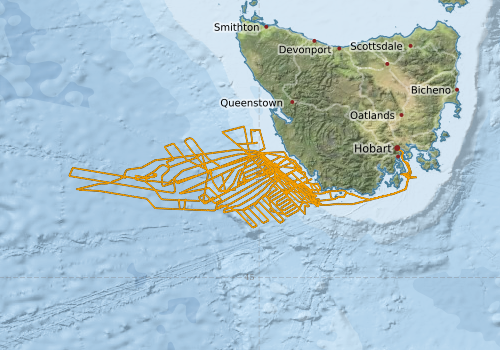
This record describes SVP data collected on RV Investigator voyage IN2023_V02, titled "Gigantic submarine landslide offshore western Tasmania: risk mitigation for shelf derived tsunami in Australia", which departed Hobart on March 24 and returned to Hobart on April 30, 2023. A total of 17 SVP casts were conducted over the duration of this voyage using a combination of the Valeport MIDAS SVX2 sound velocity profiler (13 casts) and rapidCast SVP (4 casts). The Valeport MIDAS SVX2 was attached to the CTD frame and deployed with the CTD casts, therefore SVP & CTD share common deployment cast numbers. In addition to the SVP cast data, 164 SV profiles were derived from SST (sea surface temperature) data with climatology. Data are stored in ASCII format files at CSIRO. Additional information regarding this dataset is contained in the GSM data acquisition and processing report. Additional data products may be available on request.
-
This record describes multibeam echosounder data collected on RV Investigator voyage IN2017_T02, 'Collaborative Australian Postgraduate Sea Training Alliance Network (CAPSTAN): Training the Next Generation of Marine Scientists'. The voyage took place between November 14 and November 26, 2017 departing from Fremantle (WA) and arriving in Hobart (TAS). The Kongsberg EM122 multibeam echosounder was used to acquire seafloor bathymetry, backscatter information for a total of 3054 km primarily for surveying the bottom of the canyons in the sampling area and also in deep water >1000m on the transit back to Hobart. The EM122 provides a 1 degree by 1 degree angular resolution. The echosounder's nominal frequency is 12 kHz. Data are stored in *.all raw format for bathymetry and backscatter at CSIRO. There are 213 files totalling 7.46 GB of raw data in this dataset. Sound velocity profiles were applied to this data during data acquisition. Bathymetry data contained in *.all format are corrected for motion and position. Tide corrections were not applied to the processed data. Processed data had outliers removed. Processed line data are available in *.gsf and ascii format. Additional information regarding this dataset, including information on processing streams, is contained in the GSM data acquisition and processing report. Additional data products may be available on request.
-
This record describes scientific split-beam echosounder data collected on the RV Investigator voyage IN2015_E02, which departed Hobart 2015-04-07 and returned on 2015-04-14. This voyage is a trial of the new vessel for conducting benthic biological sampling. The Simrad EK60 split beam echosounder was turned on for testing. No processing or QC has been conducted on this data. Data are stored in *.raw, *.bot and *.idx format at CSIRO. There are 161 files totalling 19.5 GB of raw data in this dataset. Additional information regarding this dataset is contained in the GSM data acquisition and processing report. Additional data products may be available on request.
-
This record describes scientific split-beam echosounder data collected on the RV Investigator voyage IN2016_V02, which departed Hobart on the 14th-March-2016 and returned to Hobart on the 16th-April-2016. The Simrad EK60 split beam echosounders 18, 38, 70 120, 200 and 333 kHz were used to acquire acoustic backscatter data to a range of 1500 m. All frequencies were logged continuously for the extent of the voyage. The frequencies were] set to passive for the periods of the voyage. Data are stored in *.raw, *.bot and *.idx format at CSIRO. There are 780 files totaling 70.6 GB of raw data in this dataset. No processing has been conducted on this data. Additional information regarding this dataset is contained in the GSM data acquisition and processing report. Additional data products may be available on request.
-
This record describes scientific split-beam echosounder data collected on the RV Investigator voyage IN2019_T03, "ORCA: Using the Investigator radar as a moving reference for the Australian operational radar network" which departed Darwin on the 23 December 2019 and returned to Henderson on the 2 January 2020. The Simrad EK60 split beam echosounders 18, 38, 70 120, 200 and 333 kHz were used to acquire acoustic backscatter data to a range of 250-1500 m between Darwin and Henderson. All frequencies were logged continuously for the extent of the voyage. The 70kHz was set to passive for short periods of the voyage. Data are stored in *.raw, *.bot and *.idx format at CSIRO. There are 407 files totalling 39.7 GB of raw data in this dataset. No processing has been conducted on this data. Additional information regarding this dataset is contained in the GSM data acquisition and processing report. Additional data products may be available on request.
-
This record describes sub bottom profiler data collected on RV Investigator voyage IN2019_T03, "ORCA: Using the Investigator radar as a moving reference for the Australian operational radar network" which departed Darwin on the 23 December 2019 and returned to Henderson on the 2 January 2020. The Kongsberg SBP120 (sub bottom profiler) was used to acquire data containing the specular reflections at different sediment interfaces below the seafloor. The SBP120 provides a 3° by 3° angular resolution. The echosounder's frequency sweep range is from 2.5 to 7 kHz. The SBP120 was logged continuously for the extent of the voyage. Data are stored in *.raw (538 files 10.3 GB) raw and *.seg (534 files 10.2 GB) segy formats at CSIRO. The segy format data had a real time processing stream applied, which applies gain, a gain correction, matched filter with replica shaping (for linear chirp) or bandpass filter (for ricker pulse), and time variable gain. Additional information regarding this dataset is contained in the GSM data acquisition and processing report. Additional data products may be available on request
-
This record describes gravity data collected on RV Investigator voyage IN2019_T03, "ORCA: Using the Investigator radar as a moving reference for the Australian operational radar network" which departed Darwin on the 23 December 2019 and returned to Henderson on the 2 January 2020. The gravity meter instrument is a MicroG Lacoste Air-Sea II. Data are stored in .ENV and .DAT data files at CSIRO. There are 12 files totalling 188 MB of raw data in this dataset. A wharf tie was undertaken at BAE Systems in Henderson, WA using a Scintrex Autograv CG-5. Wharf tie data can be found in Henderson_wharf_tie_in2019_t03_20200102.TXT, which is stored with the raw data. No processing has been conducted on this data. Additional information regarding this dataset is contained in the GSM data acquisition and processing report.
-

This record describes scientific split-beam echosounder data collected on the RV Investigator voyage IN2016_V04, 'Influence of temperature and nutrient supply on the biogeochemical function and diversity of ocean microbes' which departed Sydney on the 31-Aug-2016 and returned to Brisbane on the 23-Sept-2016. The Simrad EK60 split beam echosounders 18, 38, 70 120, 200 and 333 kHz were used to acquire acoustic backscatter data to a range of 1500m, around Montagu Island and Bermagui reef. All frequencies were logged continuously for the extent of the voyage. In very shallow water (<150m) a fixed delay of 100ms was set for the EK60 in order to prevent punching holes in the EM710 data. Data are stored in *.raw, *.bot and *.idx format at CSIRO. There are 2,723 files totalling 72.5 GB of raw data in this dataset. No processing has been conducted on this data. Additional information regarding this dataset is contained in the GSM data acquisition and processing report. Additional data products may be available on request.